


Our Services
-

Topographical Surveys
We use high precision equipment to complete topographical surveys to give reduced levels, features and dimensions, illustrated in CAD Models and PDF Drawings.
-

Drone Surveys
High fidelity photos and video footage for reference. We offer point cloud surveys (photogrammetry) and alignment with your site coordinate system for use in CAD.
-

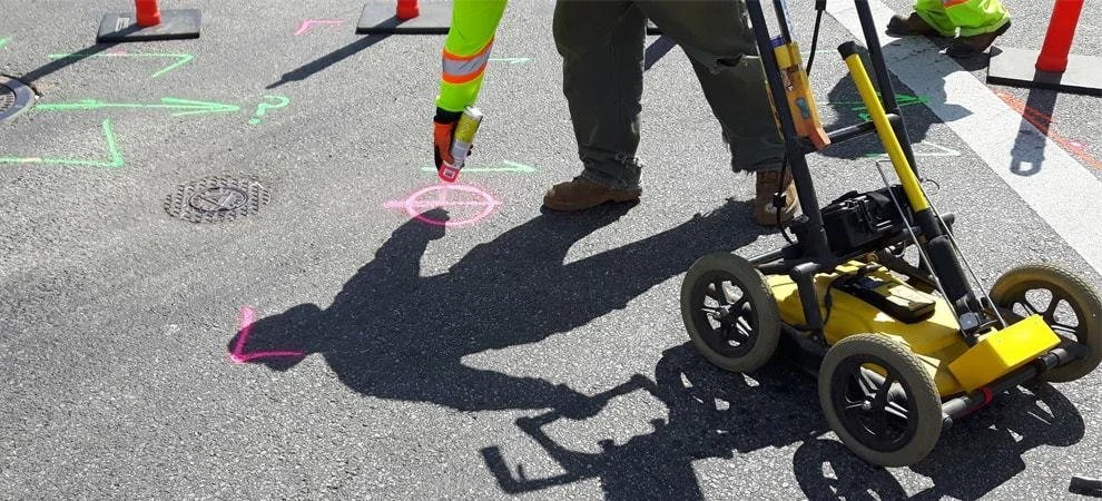
Utility Surveys
Industry standard techniques (PAS128) to perform utility surveys and discern the nature of utilities and their exact coordinates and dimensions.
We use CAT & Genny, GPR and GPS to produce accurate CAD drawings.
-
Internal 3D Surveys
We can provide interactive 3D surveys using Matterport cameras inside structures for use in a wide variety of applications.
This includes residential, condition surveys, dilapidation surveys and as-built surveys.
We also offer floorplans and drawings.